Wednesday 20 October 2010

Adventures new and old.

I have been amazed and somewhat overwhelmed by the response to the tales our our journey around Britain. It has attracted readers from around the world. I hope you have all enjoyed spending time with Catabout.

My personal adventures have continued, and for those who wish to find out more, you can read about them on Into the Unknown


If there are any of you out there who shared adventures with Catabout prior to 2007, either as owner or along for the ride, we would love to hear from you.

Fair winds.

Monday 6 September 2010

Postscript

So here we are, back on dry land again. A house has so many rooms. So much space.

We are getting our land legs back and the weather seems to be heading for autumn. My body held up, although it was a close run thing at times, but perhaps our next adventure will  make a difference with that. And we survived two months living in a confined space without killing each other.

Both of us have our own special memories of the trip, but I think we are glad to be home. Once more round the island? Not for a while. On the other hand, going over to the continent seems attractive......

Over the next few days I'm going to tidy up the blog, putting in the missing photos, and create a page of highlights and low points. Come back and look if you wish, otherwise thanks for reading, and I hope it gave you as much pleasure as it did to me in creating it.

Sunday 5 September 2010

Home again, home again, jiggetty jig

We are back in Tollesbury! We did it. A week later than planned, but hey, who's counting.

Robin arrived back in Dover by train on Friday afternoon, so in the evening we left the marina. Outside Dover harbour the sea is quite confused because of the meeting of water flows down the North Sea and up the Channel. However this is Neap tides, where the flow is at its lowest, so it could have been worse. Neap tides are also popular with Channel swimmers. I saw one come in when on the seafront that morning, and many more were making their way across the 22 miles.

 Once we had dodged our way through the numerous ferries leaving and entering Dover harbour, we caught the tide up the channel to Ramsgate, anchoring for the night in Pegwell Bay, in the shelter of the harbour there.

Saturday morning saw us rounding North Foreland for the Thames Estuary crossing. The estuary if full of sandbanks, with shipping channels inbetween. Imagine spreading out your fingers and then pressing your hand firmly into damp sand. The resulting pattern is similar to that of the bottom of the estuary. Add in the big shipping that also uses these channels and the movement of the banks after every gale and you have the potential for a 'fun' time. The combination of wind and tides can lead to some very uncomfortable seas in a yacht.

We were lucky. A sunny day, neap tides, and light winds made a pleasant day's motor across. The sand banks and channels have some wonderfully evocative names: the Sunk, Knock John, Black Deep, Barrow Deep. We even got to do a little sailing as we approached the River Blackwater. Timewise we were under no pressure as the cill at Tollesbury did not have enough water over it until at least 7pm.

Picking off the local landmarks that said "home". First Gunfleet Sands Wind Farm. Then the now redundant Bradwell nuclear power station. The saxon built St Peter's Chapel on the Flats. The colourful beach huts at West Mersea. The traditional Thames barges out for a weekend sail from Maldon.

And suddenly there we were, going up the Fleet, and Woodrolfe Creek, back to Tollesbury, where all this began.

We did it.

Monday 30 August 2010

White Cliffs of Dover

Had chance to mooch about Dover today, before Robin gets the train back home. The seafront has obviously been recently redone and looks very good. The Castle is English Heritage and looks like it's well worth a visit. As well as the medieval keep, there is a roman lighthouse and the Napoleonic cliff tunnels.

The town museum has a 3000 yr old ship that was dug up, and nearby are the remains of a Roman villa. Should be plenty to keep me occupied.

Robin went for a quick recce round the castle and took this shot looking down from the battlements:

Sorry about the colour, but the light was fading.

Sunday 29 August 2010

Gale warnings issued.

Sitting in Dover waiting for the gales to wear themselves out.

We set off this morning from Eastbourne, hoping to make Ramsgate tonight, with a view to crossing the Thames Estuary tomorrow.  No such luck. As we approached Dungeness, the radio beeped out a message from the coastguards: Gale Warnings.


Thames, issued on Sunday 29 August 2010 at 0350 UTC
     Northwesterly gale force 8 expected soon, veering northerly and increasing severe gale force 9 later
Dover, issued on Sunday 29 August 2010 at 0946 UTC
     Northwesterly gale force 8 imminent

Force 7 is bad enough in a yacht, 8 and 9 is beyond a joke. We had hoped to make it before the storms hit, but it wasn't to be.

So Robin is getting the train home, and I'm staying with Catabout until next weekend, when hopefully we can take her home.

 51 07.233'N  01 18.661' E

Saturday 28 August 2010

So near and yet so far

Out of Chichester Harbour at 7am this morning, and off further east down the coast, motoring all the way. We made good progress with the tide and it was a sunny day, so were feeling optomistic. We crossed the Greewich Meridien  at 2pm. But Catabout hasn't quite got enough boat speed to get us all the way passed Dungeness before the tide turned. As the Dover Straits are where the North Sea tides and English Channel tides come together, the timing is crucial, or you can find yourself going backwards.

So having rounded Beachy Head, we looked for somewhere to stop for the night. Rye, one of the Cinque Ports of old, but now silted up and available for a limited time each tide, was out of the question. Hastings is only suitable as an emergency anchorage, so we were left with Eastbourne Marina.

So we turned in towards the coast, passing large numbers of racing yachts, flying through the water at full speed. It turned out to be Eastbourne Regatta this weekend. The marina is entered by a pair of locks, big enough to take several vessels  at a time.  Once inside, the development is huge.

With just 100 miles to go, I don't now if we will make it in time to complete the circuit within our 58 days. Tomorrow's weather looks good, but Monday when we need to cross the Thames Estuary to get home is looking bad, with strong winds from the north west - just the direction we need to head in.
Fingers crossed.

50 47.474' N  00 19.563' E

Friday 27 August 2010

Chichester

We escaped Portland on a gap in the weather in the afternoon and made for the Isle of Wight and the Solent. Motoring all the way, we made good progress, arriving at St Alban's Head at the change of direction of the tide, so as to minimise the problems going over St Alban's Ledge, which is notorious for overfalls and eddies.

As we neared, another yacht radioed us to check which was the best route, as he was unfamiliar with the area. Robin was able to reassure him, based on both the official almanac information and his own previous experience, that close in plus this state of the tide was the best option. It was a little rough, but not too bad.

We carried on passing the Jurassic Coast and Durdle Door, debating the point in the film, Far From the Madding Crowd, where Gabriel Oak's sheep went over the cliffs. The sun went down and we continued towards the Needles, where the tide caught us and we flew into the Solent. Trying to pick out the correct lights was confused a little by a firework display on the coast. We anchored off Yarmouth for a few hours rest, while the tide changed.

In the dawnlight we set off along the Solent, which is a very busy area. Southampton and Portsmouth ports , the naval base, ferries in all directions, and huge numbers of yachts all use this stretch of water.
We picked our way through, and passed the midwater forts and underwater barrier, to go to Chichester Harbour. This is a very pretty location, and we went up to Chichester Marina for the night. Robin went off to investigate Chichester, while I slept!

50 48.173' N  00 49.019' W

Thursday 26 August 2010

Henry VIII's Castle

Portland Roads has been a refuge for ships in bad weather for centuries, and control of the harbour area has been vital. During the sixteenth century when Henry was falling out with most of Europe because of his divorce from Katherine of Aragon and formation of the Church of England, a number of fortifications were built along the south coast to protect against invasion by the French and Spanish.

Some of these still stand, one being Portland Castle now in the hands of English Heritage. While our laundry dried at the Marina, we wandered around the castle, looking out of the gunports to see how it would have dominated the harbour. It remained armed and garrisoned for nearly 250 years, then serving as a prison, private house and military barracks and an embarkation point for the D-Day landings in the Second World War. Two of the big Phoenix  Caissons, intended for Mulberry Harbour are still at Castletown Pier.

The rain has stopped, but the wind is still strong.

Stormbound still

Portland Marina is huge. No other word for it. Because Chesil beach is at one side, westerly winds whip over, but you feel totally secure, and the pontoons are wide enough to walk on even in strong winds and rain - I know, I've tried.

The gales and strong winds will pass, but when? Can we find a window to get to the Solent, where we would be pretty well sheltered? Then to Brighton; then Ramsgate; then home. Sounds easy when you  say it like that, but so near and yet so far. At least a good rest.

Tuesday 24 August 2010

Mad dash round Portland

When the fishing boat "Rachel" came back in to harbour, Robin checked with the crew and they reported the wind and waves were decreasing. A quick check on the weather reports and we were off. A short window should allow us around Portland Bill and maybe a little further to the Solent, if we sailed into the night.

The wind and waves were better than some we have experienced, but by no means ideal. At least it was sunny and dry. The fishermen had also advised going close in around the Bill to miss the 'Race' (turbulence where two conflicting tides from either side of the point meet up), otherwise it's 5 or 6 miles out, and no guarantee of good seas.

As we neared Portland, the waves were mountainous, breaking over Catabout, and coming at us beam on. But, as predicted the Race was further out, and we turned, leaving the waves to come from behind us as we passed the Bill. By this stage, I was being reminded by my body that stress and MS don't mix, so we opted for Portland Marina. As the seas lessened I made it to bed and Robin brought us safely to harbour.

50  34.364' N  02 27.141' W     211 miles to go

Effect of a good meal and a good sleep.

Feeling much more positive this morning after a good meal and a night spent in the inner harbour. We were rafted up to another yacht, a 54 foot Moody, who set off early this morning to round Portland and get back to the Solent. As a much bigger boat, it has a much greater speed through the water, and can handle conditions more than we can. Once they were gone, we tied up to the dock wall, remembering to allow for the drop in the tide.

Weather forecasts are  now our obsession, as we look for a window to allow us to get further home. The net is both a blessing and a curse, as there becomes so much information to wade through.

Meanwhile, Bridport/West Bay is nice enough to hole up in. There is a difference, to locals at least, between the two locations, but I can't work it out. It's a small holiday place, with a number of flats and apartments overlooking the sea to rent and a caravan park. There is a local fishing fleet  based in the tiny harbour, whose produce, scallops, we enjoyed last night, and a number of quayside cabins selling fresh caught fish and chips, plus other snack foods to the holidaymakers. A number of smaller boats offer day trips out into Lyme Bay or along to Lyme Regis, but are not operating at the moment. Something to do with the weather?

Another refugee from the storms, a small yacht trying to go the other way, towards Dartmouth, is now rafted up against us. She spent last night rafted to a fishing boat, which goes out every day whatever the weather.

Monday 23 August 2010

Gales

The best part of last night was the firework display that went off at 1030pm on the harbour wall - we had a prime site for viewing. Kudos to the man who went out there in this weather and let them off. This makes our third firework display: Fowey, Brixham and Bridport.

Nature provided the fireworks for the rest of the night as the storm system passed over. Today is sunny and less windy, but the waves are still high, giving a half metre surge here in the harbour. More strong winds are forecast for later.

Robin is worried that we may be stuck here for a week, but that is one of the 'joys' of sailing, and a lesson for life, you have to deal with what is thrown at you. Personally, lack of sleep and the prospect of more storms, an uncomfortable night and more to follow, and I've gone off sailing. I can see why Ellen Macarthur wept sometimes on her round the world trip. And  unless the weather eases we may not make it home in our time allowed. 230 miles to go.

Ask me tomorrow and I will probably feel differently.

Sunday 22 August 2010

And this is August?

The forecast of gales along the channel and across southern England tonight made us look for a short hop that we could do before the  weather closes in. Rounding Portland Bill was out of the question. Catabout hasn't the boat speed to be sure of getting  past in time.There aren't very many safe harbours once you leave the eastern end of Lyme Bay behind.

Thankfully Bridport, at the northern end of Chesil Beach was an option. We have moved further in the homeward direction, but should be sheltered from the gales. Now its a case of sit it out until the next break in the weather.

The Round Britain Race I mentioned at the start of this blog is due to begin tomorrow from Cowes, round the Isle of Wight and east up the channel heading for Ireland. I don't envy them at all.

Tonight we are just hunkered down, with a bit of luck we may see Bridport itself sometime tomorrow, weather permitting.

50 42.563' N  02 45.848' W

Saturday 21 August 2010

Brixham, part of the English Riviera

At 2pm we slipped our mooring at Salcombe, filled up at the fuel pontoon and made for the open sea. Our intention was to round Start Point, then having the wind and waves behind us, cross Lyme Bay, round Portland Bill and anchor in Warbarrow Bay. The first hour or so would be uncomfortable, but thereafter alright, as the tide would be with us too, making for an OK passage.

The sea as we exited Salcombe was quite rough, and the motion unpleasant. For the first time on this trip, both Robin and I were 'stomach aware'. Even rounding Start Point, although better, Catabout was surfing the waves, and rolling from time to time. We looked at each other and then the chart, to review the options available to us. Meanwhile in the background the Coastguard were talking on the radio to a number of boats in difficulties.

Initially we considered Exmouth, but saw that Brixham, as well as being closer, was going less out of our way, so robin worked out our new route, changed our destination on our AIS transmission, and we headed for harbour. Brixham Marina were able to give us a berth, so at 7pm we tied up and settled down to review our progress and work out how far we could get before the weather closes in again.

50 24.015' N   03 30.492 ' W

Friday 20 August 2010

Station not available

Another day stuck in port waiting for the winds to drop. Even if they drop here, the bad weather is gradually moving east, so we run the risk of catching it up as we head east. A dilemma.

It is raining, but we are snug in our floating home, with almost all mod cons. TV we haven't missed, but radio has been a frustrating experience. We brought a digital (DAB) radio with us, but more often than not around the UK the screen displays "station not available". Thankfully it also receives FM and longwave, so we've still been able to listen to something.

Ironically the internet has been our major source of the digital only stations. There is a long way to go before analogue radio is truly ready to be replaced.

So back to audio books and soduko.

Thursday 19 August 2010

Strong Wind Warning

 Looks like we are here for at least another day. The inshore waters forecast and coastal forecast both indicate strong winds for this area, and our next passage, across Lyme Bay, has no refuges once we set out if the weather is bad.

Strong winds are forecast
For coastal areas up to 12 miles offshore from 0600 UTC Thu 19 Aug until 0600 UTC Fri 20 Aug

24 hour forecast:

Wind -South or southwest 4 or 5 increasing 5 to 7.
Sea State-Moderate, becoming rough in west.
Weather-Showers then rain and drizzle.
Visibility-Good, becoming moderate or poor.

Outlook for the following 24 hours:

Wind-South or southwest 5 to 7, decreasing 4 or 5.
Sea State-Moderate or rough.
Weather-Rain or drizzle, fog patches.
Visibility-Moderate or poor, occasionally very poor.
 
Used today to stock up on various essential supplies: wine, sweets, ham, strawberries and cream. Oh and hydraulic oil for the steering system. Shoping is back to separate shops for separate things; no massive under one roof supermarket. So the butchers for ham, the winemerchants for wine, sweet shop for treats, general stores for the strawberries and cream.

On the water taxi we spotted a couple of boats we had seen in other ports. It is a small world.


Boats, boats everywhere.

Salcombe is dominated by the water, boats of all shapes and sizes, from expensive motor yachts to kayaks, and movement is constant. Like Venice, but with all the water moved out to the side. Water taxis and ferries whizz around, moving people from one place to another.

The town itself is fairly small, and easier to get around than Fowey, the hills here being gentler and more rounded. It is dominated by the holiday trade, many of the houses being second homes or holiday lets. The recent money squeeze, plus the positive actions by the local council should help stop places like this becoming ghost towns in the winter.

There are still a number of small traditional boatyards along Island St, mostly specialising in power boats or the local clinker built style. Close by are the chandlers, that sell real yachting stuff, unlike the high street that sells expensive yachting lookalike wear. Divers don't spend much, but yachties are even tighter.

The harbour master issues all visiting yachts with a bottle of phosphate free washing up liquid to help look after the local environment, and the book issued talks further about protecting the marine environment.

Tuesday 17 August 2010

Sweet smell of home

One thing we have noticed going round the UK is the definite smell of the land, which definitely changes place by place. Each coast and each harbour has its own. Living on the land, and often in one place, we tend to lose contact with that part of our senses, although our pets recognise the scent of 'home'.


 Now that we have our noses filled with the smell of the sea during the day, approaching land, particularly if there is an off-shore wind, there is a recognisable smell. Scotland had a definite peaty smell, and as we approached North Cornwall from Ireland, Robin recognised the scent from his childhood.

As we move up the coast, there is a definite change, a hint of farm on the air.

So today we went on to Salcombe. A pretty harbour, whose sand bar was made famous was made famous in Tennyson's "Crossing of the Bar".It looks like a river estuary, but is in fact a sea water inlet. We moored at 6pm, picking up one of the visitor's buoys. Then dinner in the cockit, with a chilled bottle of wine, to the sound of Vaughan Williams, watching the sun set over the South Hams, Devon.

50 14.805' N  03 45.358' W

Fireworks

Today at the regatta was fun. All sorts of stuff going on in the town, the boats on the water all dressed up, the passage race from Falmouth came back. A passage race is like a reverse of a normal race, where you leave when you want, but have to be back at a certain place by a fixed time.The finish time is fixed for everyone, regardless of when you actually arrive. But too late and you are disqualified. So everyone leaves as late as they can to get the shortest passage time, keeping an eye on the other boats. To make things complicated, different types of boat have different handicaps....

Finish time approaches and all the boats pour in, hoping to get here just in time. The skill is in working out your route, time and tides to the nth degree, with just enough margin for the vagaries of the wind.

A brief visit by tender to Polruan, the more traditional un-gentrified cornish village facing Fowey across the river, before back to Catabout for  our evening meal and wait for the highlight of the day, the fireworks. At 9:30 the display began, and we were in a prime site, sitting on Catabout's coachroof and watching the spectacular effects. Watching fireworks from the water is magic.

Because of the shape of the harbour, we got a triple bang, as the sound echoed off the hillside behind us and off the slopes of Fowey. As the glow of the last rocket faded away, all the boats sounded their horns and hooters and the sublime madness filled the harbour.

Well worth staying for.

Monday 16 August 2010

Enjoying Cornish Sunshine

A rest day, just mooching about Fowey, and puttering about in the tender. The August sunshine was warm on the skin, but not too hot, and the town full, but not overwhelmingly so. The streets are decorated with bunting, and many of the shop fronts are also given a festive trim. We got a newspaper to read for the first time in weeks.

We were planning to leave tomorrow morning, but as it is to be the start of Fowey Regatta Week, with events during the day and fireworks in the evening, we are staying another day. Many of the boats are covered in flags, known as being dressed overall, and the river is becoming a very colourful sight.

There are a group of three young men on the boat moored next to us who are preparing it for crossing the Atlantic in November. Everyone has their adventures and dreams.

Sunday 15 August 2010

Fowey

Fowey is the harbour of harbours. It ougt to be a kingdom of its own. In Fowey is all courtesy, and good reason for the chance sailing man. For your provision, or your transport, or your mooring, you may pay no more than you should, and whatever you may need in gear is to be had at once. In Fowey there is security from all winds, good holding, and best of all, an air in which other places may be be forgotten.
Hillaire Belloc, The Cruise of the Nona.

After a very disturbed night in Coverac bay, where the very small swell caused some kind of resonance in Catabout's hull and she bounced about, we set off for Fowey. Sailing is truly all about direction. We were setting off into the wind, and had to motor most of the way and had a bumpy journey of it.

But we passed a yacht going in the opposite direction, who was having a very pleasant day's sail downwind, with just one reef in their mainsail. It was all worth it, though. Sidney harbour in Australia wins my personal vote as the perfect harbour, but Fowey is definitely second. Although a sunny saturday in the middle of august, and seemingly jam packed full, the harbour patrol found us a fore and aft mooring and helped us fix up our lines. The location is delightful, and well worth the visit.

We took the water taxi to the shore, as we were too tired to pump up the tender, and wandered around the tiny streets of the town. There are lots of interesting shops, and a fully stocked chandlers, where we got a new DSC VHF radio, to replace the one that died on us, and the 70s radio we had been using since.

Also had a fabulous meal in a little bistro we came across, that served wonerful food and wine.Steins may rule in Padstow, but Tiffins in Fowey is better. Back on the water taxi , which was thankfully easy access for me, and so to bed.


50 19.997' N  04 37.671' W


Saturday 14 August 2010

Round the Lizard

Lizard Point is the most southerly part of mainland Britain and rounding it marked the most southerly point of our adventure. It is another area where tidal flows meet and run very fast, so getting the timing right is very important.

We had the choice of either an early start or an evening sail, and after a hard day yesterday, we opted to leave at 6pm. because our course was mostly south easterly, until we rounded the point, the first part of our journey was quite comfortable in the northwesterly winds. The dish aerials of Goonhilly Downs wer visible on the hilltops. I guess you have to be a certain age for that to mean something to you.

Lizard Point is noted for the tide races and overfalls that occur there, so we took our route below 49 55' to avoid them. Even so we had a small area of highly disturbed water, where it formed peaks instead of waves.

Once round the point, we were heading into the wind, so motored up to Coverack Bay, where we should be sheltered by a headland tonight.

50 01.537' N  05 05.485' W

Thursday 12 August 2010

Cape Cornwall

So off this afternoon to round Cape Cornwall and Land's End. Cape Cornwall is one of only two capes in the UK, the other being Cape Wrath in Scotland. Getting the tide times right is essential, so Robin has plotted a number of way points with the times we must be there.

The wind is from the north, ok as we go round, but the waves will be beam (side) on as we do the last bit of this coast. And showers are forecast. Fun times ahead, but it's got to be done, and this is better than southwesterly winds, which are the usual.

After all that, we had a very pleasant passage. The waves were unpleasant until we began to turn south at Pendeen Point. Thereafter things got progressively better as we got further and further round. On the clifftops were ruins of old cornish mines, and a working modern mine.

The weather turned out to be gloriously sunny. Once passed Land's End and the Runnel Stone, Robin and I looked at each other a heaved a great sigh of relief. We had done it. We were on the south coast.

After entering Penzance Bay, we made for St Michael's Mount, and anchored in the bay close by. A fabulous view as the sun goes down.

50 07.286' N 05 29.193' W

Wednesday 11 August 2010

St Ives

This morning we left Padstow for the next hop, ready for going round Land's End. The wind was still coming from the north, so there was quite a swell coming down the River Camel as we sailed out. Once in the deeper water, we were able to turn south west and life became more comfortable.

Apart from the adrenaline soaked moment when the replacement bolt on the engine alternator block sheared again. But we've got sails and we're not afraid to use them! Thankfully Robin was able to replace, while at sea, the broken bolt with the spare he had bought, planning to put it in place when we got back to Tollesbury. And fine boat cord makes a good temporary drive belt to keep the water pump running while he got everything ready to do the job. No more complaints from me about the number and range of tools kept onboard!

So we made it to St Ive's Bay and picked up a mooring for the night. Got to work out and get timings right for the tides going round Cape Cornwall tomorrow. Another adventure.

50 12.692' N 05 28.324' W

Tuesday 10 August 2010

We're on holiday too.

Today was a real rest day and a reminder we are on holiday too.

Although the day started in a typically damp cornish fashion, it turned into a lovely sunny day. Robin finished the laundry, and I stayed in bed until it was time to strip the bedding for washing.
It was wonderful to rest amongst other folk on holiday. With an adventure like this it is very easy to constantly be moving on, moving on.

Meals were eating out in the multiplicity of eateries in the town; a pub, fish and chips in a quayside cafe; an italian overlooking the harbour and the street entertainers. Tonight was a fire eating unicyclist.

Padstow has been a wonderful break for us both, and wins the vote for best yachties laundry facilities. There was a piper during the day. The guitarist is back tonight.

Tonight, some of the working fishing boats have come into the protected harbour because tonight is a very high spring tide, combined with a northerly wind, which will push the sea swell down the river.

It will be sad to go tomorrow.

Monday 9 August 2010

Padstow

9/8/10

Arrived in Padstow harbour (right in the middle of the town) after grabbing a few hours sleep. The last 24 hours were exhausting. The channel into Padstow has a sand bar, which limits access to certain states of the tide.

So we had to wait our time in the relative shelter of a small bay called Port Quinn Bay, just up the coast from Padstow. When it was time, we came out into the swell again, passing some small day trip fishing boats containing somewhat green holidaymakers, regretting their choice of 'fun'.

Seeing the sun come up and glimpsing the north cornwall coast in daylight was a real blessing. We were also joined for a while by some porpoises, who swam alongside in the dawn light. They were supplanted by a pod of common dolphins, including some mothers with babies. Obviously we were this weeks must see in the cetacean world.

So, Padstow. A small fishing picturesque village on the north Cornwall coast, now very popular as a holiday centre. Across the River Camel is Rock, one of the summer haunts of the the youngsters of London's beautiful people including the Princes William and Harry. Padstow is also home to Rick Stein's Seafood Restaurant.

And Rick Stein's Cafe, Stein's Patisserie, Stein's Deli, Stein's Fish and Chips, Stein's Gift Shop, Padstow Seafood School, St Petroc's Bistro.

As a harbour user we get use of a wonderful shower and laundry block, and provide part of the entertainment for the holidaymakers around the harbourside. Looks like we will star in many people's holidays snaps and videos showing us coming in and mooring in style, and form part of the charming backgrounds of those shots taken eating icecream etc.

After eating at a harbourside pub this evening, whilst our laundry is whirring away in the machines in the Harbour Office block, I came back to the boat, while robin went to pick up the washing. As I sit here now, a guitarist is playing and singing meloncholy songs as the sun sets and most folk are making their way home at the end of the day. One of those magical moments.

50 32 .473' N 04 56.282' W

Rough Weather

8/8/10

We got weather forecasts from the irish coastguard and by phone from the helpful Falmouth coastguard in england. It looked like an ideal day to attempt the crossing to the Scilly Isles so long as we set off straight away. The crossing should take 36 hours, and the weather is set to worsen in 48. The second half of the journey is totally exposed to the Atlantic weather and the large rolling waves formed by the prevailing winds.

Initially the passage went well, the weather benign and we made good progress. I made some bread and some dessert to eat later. One very valuable lesson though - don't expect something to set when bouncing up and down in a boat!

However, the winds changed earlier than expected and we were soon flying, even as we reefed sail. The waves were getting bigger still, and as the wind was blowing straight from the direction we wished to go, it was getting very unconfortable.

So we made the decision to turn for Padstow in the north coast of Cornwall. The distance was not much less, but the worst of the weather would be coming at us sideways/diagonally instead of on the nose. It was a hard and tiring trip, but the worst was at night, when we couldn't see the height of the waves and so worry about them. To give you an idea of the weather, the passage we expected to take 36 hours, took only 24.

There was another bonus. As dusk fell, we were accompanied by a pod of dolphins, that played in the waves around and under the boat. Initially they were with us for about ten minutes, but were soon back and stayed about an hour. Robin took a short video, which I hope works.

51 09.278' N 05 47.720' W at midnight, sailing.

Ever onward 2

7/8/10

Left Wicklow for Wexford/Rosslare to the south, prior to heading for the Scillies. Both of us are feeling internet withdrawal symtoms, being so used to being able to check information and communicate at will.

A beautiful day, although not that much wind, so we had to motorsail for much of the way. The weather in Ireland may be wet, but rains everyday, but part of the day, so that you exerience both glorious sunshine and rain on every day. In scotland our experience was either a very wet day or a lovely dry one. We were lucky in that a heavy rain day was usually followed by a sunny one.

We anchored for the night in north Wexford Bay to get a good rest before the long trip in the morning back to England.

52 21.726' N 06 20.568' W

Wicklow

6/8/10

Today is a mooching about day, as the winds are forecast upto F6 south of here where we wish to go. Too strong for comfort, particularly as they will be blowing directly at us.

Wicklow is a nice enough place, friendly and doesn't feel at all foreign. Even the newspapers, a good measure of being in a strange place, seem much like home. The stories are the same, just the names are changed. But even there, the sports pages are full of english premier football clubs.

Wicklow harbour is very much a working fishing harbour, with boats coming and going all the time. But visiting yachts like ourselves are accomodated on the east pier of athe outer harbour, where sections have had boards and ladders added, so you can tie up safely.

We ate ashore at a chinese restaurant last night. A nice luxury, even if the streets seem to move under you as you walk. Robin is on shopping duty today, topping up our fresh stores with fruit (including some delicious strawberries) and such like. Our stores are holding out quite well, only soft drinks running very low.

Heading South

5/8/10

Left Howth at 8am and had a wonderful sail south in the sunshine,before the VHF radio crackled into life "dublin coastguard, a small craft warning" Your heart sinks when you hear these words. It is never good news. It turns out to be a strong wind warning for later on today and tonight.

Fighting tide on these coasts is bad enough, but a strong southerly or southwesterley wind as well? So we headed in to Wicklow harbour, where we tied up inside the east breakwater to wait and see what tomorrow brings.

The next boat along belongs to a Belgian who has lived in Ireland for the past 12 years and speaks english with an irish accent. A cup of fresh coffee and a break and off to investigate Wicklow.

The town is decorated with bunting - nice of them , but how did they know we were coming? Actually, I think it is left over from the Wicklow regatta festival.

52 58.966' N 06 02.042' W

Wednesday 4 August 2010

The Other reason for stopping at Dublin

Ok, come clean time here. The reason for bringing forward our dream trip around Britain is that I have Multiple Sclerosis (MS) and earlier this year I had a particularly bad attack, which stopped me working and restricted me greatly. So it was now or never.

Today I had an appointment for an investigation into one of the latest theories concerning MS, a poor blood flow from the brain via the venous system, called CCSVI or Chronic Cerebral Venous Insufficiency. Unfortunately, for many and various reasons, I have not been able to get the scan done in England.

The scan showed a very poor flow on the right side, despite the fact that my jugular vein is wide open, and a number of additional veins have developed to help carry the blood away. My left side is normal. When I sit up the jugular veins do not collapse as they should, so that the vertebral veins take over the flow. Perhaps a blockage further down causing a backup? Certainly worth having the next stage, a venogram, done.

Tuesday 3 August 2010

Dublin's Fair City

Made to Howth Marina today, where after a quick wash and brush up we headed off to view Dublin. In many ways it feels like Cambridge, right down to having a Trinity College.

And it has a Starbucks with WiFi access, so coffee it is then, while I catch up on the world.

More later.

Welcome to the Republic of Ireland

2/8/10

We said goodbye to Northern Ireland and the UK today and headed south for the Republic. A long haul across Dundrum Bay where the tides that flodd in to the Irish Sea from North and South meet up, creating an area of slack water for most of the tide.

With careful timing we were able to enter the bay with a south flowing flood (rising)tide, and leave with a south flowing ebb (falling) tide. This helped us maintain the overall speed we needed to get to our destination before dusk.

Passing Strangford Lough we experienced the powerful effect of the mass of water flowing out of the Narrows, which can reach up to 8 knots. Although two miles off the coast, the outrush of water deflected us nearly a mile further out.

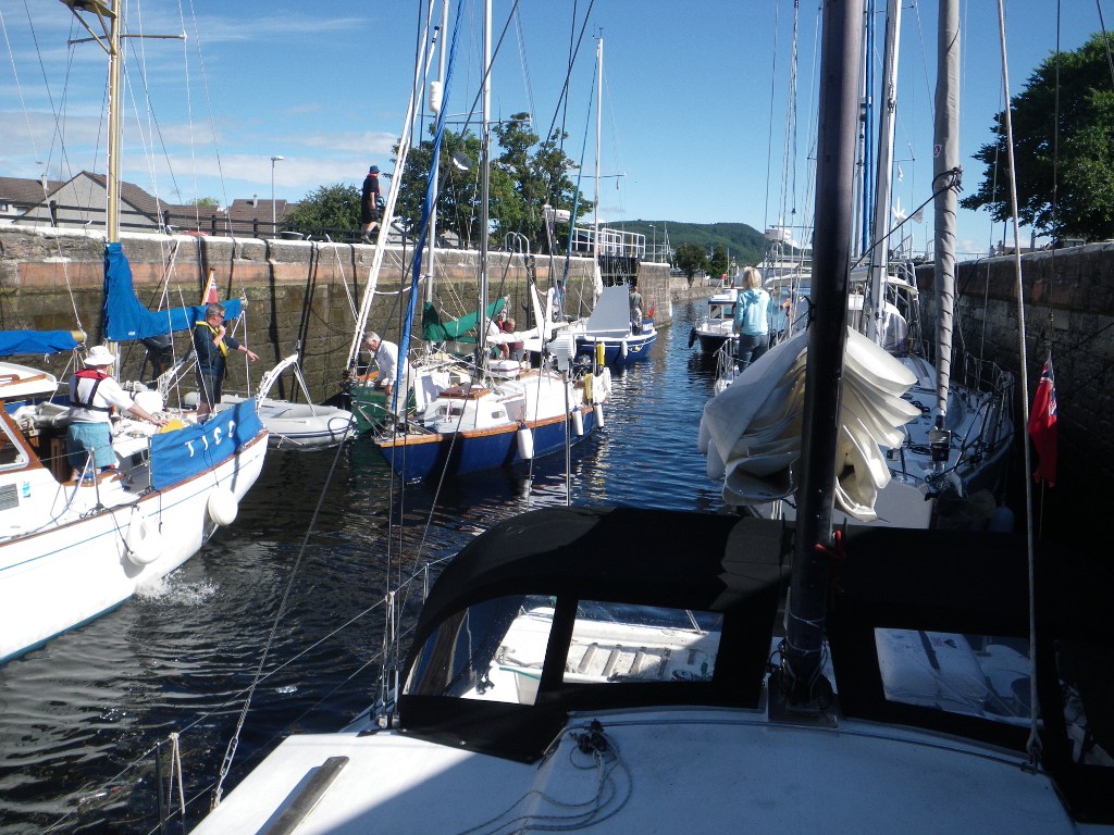
For most of the day the wind was kind and enabled us to sail rather than motor in the direction we wanted. You get atotally different view of the coast as you pass in a yacht. Things come slowly into view, then you pass and they slip slowly astern, the whole process taking several hours.

At once stage we could see Scotland, the Isle of Man, North and South Ireland. Even as we sit at anchor near Dublin, we can see the Mountains of Mourne in the distance.

Our anchorage is shared by a huge number of seabirds who colonise the cliffs of Lambay Island, a private bird sanctuary. As the sun is setting, the noise level is decreasing. Some I recognise, like the squadrons of gannets plunging into the sea with barely a splash, like an olympic synchronised diving team. Others are just a pleasure to watch.

Some get confused by the two hulls on Catabout. If sitting on the water as we approach, they swim away, but some pick the wrong direction and end up swimming in front of the other hull, then ducking below the water and coming up some way away.

Anyway, today is the halfway point in our odyssey, both in distance and time.

53 29.893' N 06 01.215' W

1/8/10

Just realised I missed out our journey from Scotland to Northern Ireland!
It was incredibly calm, the sea like glass most of the way, so we had to motor. After all the tales of crossing the North Channel, with problems of tides, winds and waves, it was almost a let down. The day was sunny and we eventually anchored in the delightfully named Knockinelder Bay, just north of Strangford Lough.

54 22.729' N 05 28.821' W

Sunday 1 August 2010

End of our first month

Last day of July and we weighed anchor at 0720 am to get as far as we could on the way to Northern Ireland, or even as far as Bangor Marina in Belfast Lough. The waters between Ireland and Scotland, known as the North Channel, have strong tides that sweep up and down the coast, so it is important that you time your crossing correctly.

The forecast said that the wind shold move round to be ideal for us to get to Ailsa Craig in time to catch the southerly tide to aid us on our way. Sadly the wind didn't change soon enough, so we had to modify our plans and head for Loch Ryan.

After several hours viewing Ailsa Craig from all angles, it is a remarkable rock, about 340m high and 2 miles in circumference. |It is a volcanic core and is visible from many miles away across the sea - hence it's knickname of Paddy's Milestone. The granite has been used to maked the best curling stones, and the island is now home to a huge collection of seabirds.

Loch Ryan is the base for ferries across to Belfast, so we had to time our entry to the small bay where we anchored around their schedule.

55 00.104' N 05 04.895' W

Sea mist and fog

Perhaps some of you remember the song Mull of Kintyre? It talks of mists rolling in from the sea.
Well that was the main feature of our day today.

We had hoped to sail to Loch Ryan, ready for the crossing to Northern Ireland, but once we left the bay at Lamlash, the visibility closed right in, and we opted to go back to Lamlash Bay and try again tomorrow. It's a lovely location, but can't get the mobile internet there!

55 32.475' N 05 06.118' W

The Isle Of Arran

The next morning we were off as soon as the sealock opened at 8am. It was a beautiful sailing day, as we went down Loch Gilp, Loch Fyne and into Inchmarnock water to the Isle of Arran in the mouth of the Firth of Clyde. The sun shone on the mountains, either side of the lochs as we headed south. The shortening of the days is noticeable now, as we get a double effect, from the passage of the days and the earlier sunset as we move south.

At the end of our sail, we anchored in Lamlash Bay, a beautiful half moon bay totally sheltered by another small island called Holy Island. Now used for retreats,it is the site of a monastery founded in the 12th century by Somerled, Lord of the Isles. There is also evidence of Viking occupation in the form of runic inscriptions in St Molaise cave.

Shortly after we anchored, we were visited by a swan and two cygnets. Robin fed the with some bread and cake, which the cygnets took, while the parent watched over them. It hisssed loudly if He got too close trying to photograph them.

55 32.475' N 05 06.118' W

Thursday 29 July 2010

Meeting up

So we met up with our friends in Ardrishaig Basin at the end of the Crinan Canal. They have been going clockwise in their large steel yacht, Friars Goose, while we have been going anticlockwise.
Onshore we live within a mile of each other.

It feels strange in some ways to have this reminder of home and normal life, afloat is our new normal.

From here we are back on the sea all the way home.

The basin is quite small, and was packed with boats, but at least you can still see some water. John told us of being in Oostende, when you could walk from side to side without getting your feet wet.

56 00.731' N 05 26.809' W

Wednesday 28 July 2010

The Crinan at last!

Having had a good night's sleep, we left for another attempt at the Crinan Canal. The weather was fine and clear, and ,by timing our passage well, going through the tidal race at Dorus Mor was fairly straightforward.

The entrance to the canal was in sight.

Unlike the Caledonian Canal, appart from the sea locks and swing bridges, you have to operate the locks yourselves. With just two onboard this can be tricky, but we were lucky enough to meet other boat crews to share the work with. Again though, there are insufficient mooring places along the canal, for the number of boats passing through. The scenery is beautiful, and the whitepainted lockkeepers cottages are delightful.

Still, we reached the half way point before stopping and rafting up with two very pleasant families ready to continue in the morning.

56 03.627' N 05 28.979' W

Tuesday 27 July 2010

Dash it chaps and other similar phrases

There we were, in the Sound of Luing, zooming along in the tidal stream at 10 knots when there was an awful bang from the engine compartment and the engine revs dropped right off. Not a good place for this to happen. Robin looked inside and a bolt holding on the alternator had sheered off, meaning we also had no coolant on the engine.

Using his tool box and draining the hot water tank, Robin did an emergency repair that allowed us to motor slowly to safety, but instead of Crinan Canal, we had to look for a destination that avoided any more tidal races. Luckily we found one on Loch Shuna called Croabh Marina - ideal! Radioed the coastguard of our situation, and were asked for half hourly updates until we reached safety.

As we approached Croabh , another yacht approached, which had heard our radio conversation with the coast guard and had diverted to see if we needed any help, or a tow into the marina. Thankfully we were able to get in under our own power, but I didn't get the boat's name, so if you ever read this, thank you whoever you are.

The marina is well equipped and in a pleasant spot, so Robin was able to get a bolt which should last us until we get home and have time for a more permanent fix. It meant lifting the engine off its mount, but what else are booms for?

Job done, we both went for a hot shower and met up with some people we knew for a meal at the hotel onshore. OH2, the motor yacht we first encountered at Amble, then Peterhead, was also at Croabh.

56 12.723' N 05 33.477' W

Sunday 25 July 2010

Serendipity

We left the Sound of Shuna early to catch the tide and went down the coast passed Oban. Once in the Firth of Lorn and Kerrara Sound (aren't the names very evocative?) we moored up in Horseshoe Bay to take a break and plan the next stages of our journey. The West Coast of the Mull of Kintyre has a tendency to be a rough trip, so we were considering using the Crinan Canal as a short cut through to Loch Fyne.

Unlike the Caledonian, in the Crinan Canal you have to work the locks yourself, so we were in two minds about being able to manage it. Really you need a crew of three or four. Suddenly Robin's phone rang. It was some friends of ours who were doing the clockwise version of our journey. They were at the Crinan Canal, wanting to get through the other way! Unfortunately Christine has hurt her leg, so Robin and John came to an agreement to help each other through the locks. The Crinan is on then.

Meanwhile we took the opportunity to rest up fully and do some tide checking. Kerrera Sound is fascinating to watch. The commercial traffic tends to go out the north end, so here we see small racing skiffs zooming across the water from side to side of the channel. Plus seaplanes land on the water near Oban, so we could watch them fly overhead.

After a break, we motored a few miles down Inish Sound to an anchorage at the south end of Seil Island for the night, in a small stretch of water between Easdale and Ellanbeich.

56 17.674' N 05 39.175' W

Saturday 24 July 2010

On the West Coast

A busy day alround. The swing bridge was fixed, and so we were able to leave Gairlochy at 8am. Neptunes Staircase, a flight of 8 locks awaited. We arrived at 10am, to find the people coming up were still in the locks, and we finally started the long descent at about 1030.

Going down is less hard work than coming up, but not without its adrenaline rushes. You have a line running from the front and back of the boat, each wrapped around a hook on the lockside, which you release gradually as the water level drops. In the third lock the stern rope jammed, leaving the boat hanging from the lock wall. Robin grabbed a knife and cut the rope before any damage could be done. He then had to throw a new rope to one of the lockkeepers to stop Catabout drifting across the lock into the boat on the other side.


After a stop to refuel and top up the water tanks, we eventually left the canal and back to thinking about tides again at 4:00pm, heading down Loch Linnhe for the Corran Narrows. Here the land "pinches" the movement of water in the Loch, so that the water can run at 6 knots - you want it to be going in your direction! There is also a ferry that links the two sides at this point, so we had to time our run through the narrows with the ferry's sailings.

Once through, the Loch opened out again, but sadly we didn't get the full benefit of the views, as the weather closed right in. Got to the Sound of Shuna and moored for the night. What a day.

56 34.947' N 05 22.862' W

Friday 23 July 2010

Canal Frustrations

It feels a bit like being a hostage to fortune. Not only did we not get up last night, but two lots of boats coming the other way were locked through before us in the morning. The Caledonian Canal is very scenic, but very slow.

Got through the staircase at Fort Augustus by 11:45, so we pressed on in the fine weather, going up the remaining locks to Loch Oich. There were a few noteworthy landmarks on the loch shores; The Well of Seven Heads (the more gory-minded of you, click on the link for the story behind the name) and the ruins of Invergarry Castle.

After Loch Oich it is down hill all the way, as the locks gradually bring us back to sea level. At the western end of Loch Lochy we caught up with the fast boats who left us behind earlier in the day, as the swing bridge at Gairlochy is not working. I hope it can open tomorrow. Meanwhile the location is stunning, in the shadow of Ben Nevis, it is sunny and we are doing the laundry at last.

Ben Nevis is stunning, and you can see the snow remaining in the valleys near the summit. An added bonus is that you can actually see the summit, as it is usually wreathed in clouds.


View Larger Map

56 54.873' N 04 59.548' W

Thursday 22 July 2010

Fort Augustus


Fort Augustus is a real tourist town at the south western end of Loch Ness. There are souvenir shops and boat tours on the lake. The original Fort Augustus, part of the chain of forts used to keep the highlanders in check after the Battle of Culloden, was coverted to a Benedictine Abbey in 1876. The Abbey was finally dissolved in 1998, when the building passed into private hands.

Because of it's position, it is a gateway to the highlands for many holidaymakers. For us it was the end of a gentle day's sailing and motoring down Loch Ness, enjoying the scenery bathed in sunlight, so different from yesterday. We passed close to the iconic Urquhart Castle, that appears in many a photo album of the area. There were very few boats on the loch: a couple of yachts and a handful of motorcruisers. At times it felt like we had the place to ourselves.

On arrival, all boats using the Caledonian Canal are required to moor at one of the pontoons, and go to see the lockkeeper about potential locking in times for the staircase leading to Loch Oich. We arrived at 3pm, and were unable to get a time, other than it would be sometime before the locks closed for the night.

One of the good things about the spot is that it has one of the British Waterways Users laundry facilities. We've been afloat three weeks, so use your imagination!

Then the bad news: the washing machine just broke down as a german couple were using it and we can't get through the lock tonight. Oh well. At least it's a nice spot.

57 08.777' N 04 40.550' W

Wednesday 21 July 2010

A Day of Rest 2


The weather is not good today and the views going down Loch Ness are not to be missed, so we have opted to have a rest day today and are stopping here in Dores bay for a break.

It is nice and cosy in the boat with the sound of rain on the coachroof above our heads. I've taken the time to add some photos to past posts, so go have a look.

Tuesday 20 July 2010

Desparately seeking Nessie

I felt I had to share with you our encounter with one of life's true individuals here on the beach at Dores. This trip is all about living the dream, not just dreaming it, and the man we met was also living his dream.

Steve Feltham lives a converted mobile library van on the beach at Dores, and is a full time Nessie hunter. Inspired by a childhood encounter whilst on holiday with his family in Scotland, in 1991 he sold his house in Dorset, in the south of England, and moved to the Loch to pursue his dream to find the Loch Ness creatures.

You can find out more about him on his website, or on his Facebook fan site.

Fresh Water Sailing


The sea lock opened for us at about 0750 this morning, and we moored on the canal at

Dochgarroch, taking a breather before the final lock before entering Loch Ness itself. The name canal is a misnomer, as the bulk of the journey is through four lochs in the Great Glen:Loch Lochy, Loch Oich, Loch Ness and Loch Dochfour. The canal sections has 29 locks, to raise and lower the boats up to 32m above sea level.

On this stretch, we encountered our first simple locks, swing bridges and staircase, where the top gate of one lock is the bottom gate of the next. Locks are hard work, even when the lock gates and sluices are operated for you by the British Waterways staff.

Each "locking" contains as many boats as possible, to maximise throughput and minimise loss of water. Our first experience contained eight boats, including ourselves. There we met up with another of the boats who had been stuck with us at Peterhead, plus a nice swedish couple who were off around the world. Scotland was their first experience of dealing with tides.

After Dochgarroch, we motored gently through the loch, passed Dochgarroch House and Aldourie Castle into Loch Ness. We have anchored just off Dores and are off to the pub.

57 22.931' N 04 20.180' W

Monday 19 July 2010

Inverness bound


Off again today, making further way towards Inverness and the entrance to the Caledonian Canal. This goes down the Great Glen, via Loch Ness, coming out on the west coast of Scotland near Oban.

The winds were very light, so we motor-sailed to Inverness, passing many evocatively named places along the way: Portknockie, Lossiemouth, Findhorn, Munlochy...

There were many seabirds along the coast, and some off-shore in large gatherings, which we assume indicated shoals of fish below the surface. I wanted very much to see seals and dolphins on the way, but it took until the entrance to Inverness Firth before we saw any.

As we were motor-sailing, I took the opportunity to do my party piece - bake fresh bread on board. While the bread rolls were rising, I also made half a dozen blueberry muffins to have with a drink of hot chocolate during the passage.

The approach to the Caledonian Canal is very scenic. While the eastern side of the Firth is more developed, the western side is more mountainous, with small villages on the shoreline, backed by steeply wooded hillsides. It could very easily be an alpine lakeside.

At Inverness itself we came under the spectacular Kessock Bridge. Because we came through at the top of the tide, it was quite easy; but on the ebb spring tides, and after heavy rains, the combination of tidalflow plus the rivers that feed this area can give a flow of over 6 knots under the bridge.

So we are moored up at the Clachnaharry sea lock, waiting for it to open at 8am tomorrow morning. We then have 8 days to traverse the length of the Canal. No tidal calculations for 8 days!

So far we have passed both the most easterly and most northerly points in our journey. South and west await.

57 29.446' N 04 15.818' W 533 miles done, just under 1/3 of the way.

Ever onward

We woke early yesterday, and had a chance to view our surroundings before heading off for the day. There were a few houses on the slopes down into the bay; traditional ones being side on to the sea, presenting the minimum face to the winter gales, and the more modern ones, looking out over the sea. The bay itself was quite stunning, with a number of rock arches carved by the action of the sea on the rocky shore, one large one, and a number of small ones.

The cliffs were home to huge numbers of seabirds. I'm not well up on bird spotting, so I'm afraid I can't tell you which types, but they were quite a sight, wheeling in the air.

Weighed anchor at 9am to catch the tide. Initially, although grey and overcast, the winds were 18knots and favourable, so we made good progress. Along the coast we were passed by Tico, a large motor sailing boat that we had seen at Peterhead.

However, later in the day the wind moved round so that it was blowing almost directly from the direction we wished to head, not good for a sailing boat, and became very squally, dropping to almost nothing, then surging to 25+ knots. This becomes very tiring very quickly when sailing short handed like us (fine if you have a large crew) so we called it a day and headed in to Cullen Bay to anchor for the night.

I don't know what was going on in the town, but the sound of bagpipes swirled out across the water to greet us as we came in close to anchor. Very atmospheric.

57 42.005'N 02 49.622'W

Saturday 17 July 2010

Off at last.

Finally made it out of the harbour and under way today. We had to wait for a cruiseliner, the SAGA Pearl, to come in before we could leave, but then we were off.

The waves were a bit rough coming out of the harbour, but once we were well clear and turned north, the rollers were following us and much more comfortable. Rattray Head was not as bad as expected, but now we've turned the corner and are heading for Inverness.

At the moment we are anchored in Fraserburgh Bay waiting for the tide to turn in our favour again. For the more technically minded, who wish to follow our progress closely, see Ship AIS. (www.ShipAIS.com)

Unfortunately, the wind continued to blow directly from the direction we wanted to travel in, so even tacking non-stop haven't made a huge amount of progress and are anchored in Aberdour Bay for the night.

57 40.790'N 02 11.145'W

Friday 16 July 2010

Well, we're still here.

There's quite a sense of community building up between the different boat crews trapped here by the weather. We were joined last night by another dutch boat.

No need to consult the weather reports and forecasts today to see if it's fit to go out. In Peterhead Bay, ie inside the breakwaters, are rollers that wouldn't look out of place on a north Cornwall beach, or anywhere else that surfers eye, looking for the perfect wave.

Outside the breakwaters the waves are an average 2.5-4 metres in height. An average two storey house is 5 metres to the eaves.

So another day in port then.

Thursday 15 July 2010

Convoy!

There's now six boats at least sitting in the marina here, waiting for that elusive gap in the weather. A young swedish couple, a dutch couple, a belgian pair and three british crews that we know of. A pair of german guys in a very racy looking boat made it out last night, but they were heading south.

Every so often there is a huddle around the marina office notice board, as the latest local weather forecast, supplied by the port authority goes up, and drooping heads as we realise, not yet.
The fishing crews round about us think a couple more days of serious swells then it should be ok.

Sailing is both a very enjoyable, very relaxing way of spending time and extremely frustrating.

You have no control over the wind and waves, and it is a very salutory lesson that there is much in this life we cannot dictate.

Wednesday 14 July 2010

Stages of Seasickness


The jokey version is :
1. You're afraid you are going to be sick
2. You're afraid you are going to die
3. You're afraid you are not going to die.

For most sailors :
1. You become aware of your stomach
2. You become aware of your throat
3. You start to burp
4. You are sick
5.You get your sealegs.

Many famous mariners have been troubled by seasickness, including Nelson. Everyone who goes to sea reaches one stage or another, the lucky ones going straight to stage 5 and stay there.

This morning we tried to go out to get round Rattray Head. The tides here seem to have a life of their own, not as shown in the Almanac, so we asked the Harbourmaster for local information.
We had until 10am to have the ebb tide flowing south to north to sweep us up and around Rattray Head.

So we tried going out at 7am. Once outside the breakwater the sea was rough and confused and the fog closed in. With the prospect of another 2-3 hours of this and I was at stage 2 and contemplating stage 3 we opted to head back to Peterhead. Robin made a good job of getting Catabout back in, so much so the Harbourmaster radioed "welldone".

I didn't think Peterhead would be a welcome sight, but it was today.

Oh well. Maybe later.

The picture is a snapshot from the Peterhead webcam:
http://www.aberdeenshire.gov.uk/webcams/peterhead.asp
Catabout is extreme left at the front as you look at it.

Best laid plans and all that.

Quarter past six and the wind is still up, and rollers are making their way into the harbour, passed the breakwaters. This was not in the plan.

Robin went for a walk to the outer sea walls and saw big rollers and rough seas north of here.

So detailed review of the weather forecasts, tide tables, tidal stream atlases, wind and wave predictions to see if we've got to tough it out, or if there is a better window in the weather.

So it looks like daybreak tomorrow off and round Rattray Head and into the Moray Firth, where conditions should ease. Got to go tomorrow, because Friday onwards sees gales and stormy seas.
Don't want to emulate a friend of ours who was stuck here a fortnight.

Perhaps I shouldn't have watched the tv series Trawlermen before our holiday.

Postscript: the fishing boat berthed near us in the marina just came in, having never made it outside the main breakwaters because of the rough seas. Nice to have your decisions confirmed, because if a fisherman doesn't fish, he doesn't earn. But then he talked about 2 metre rollers tomorrow morning too.

As they are easterly, it's not too bad once we've rounded the corner, but there's still at least 6 miles due north to go, with the rollers coming at us side on.......

Amazing what a good sleep does

In order to catch the tide going our way we either had to leave at 5 in the morning or 5 in the evening. We have opted for the evening tide and are using today to catch up on jobs on the boat.

A damn good tidy and a hoover by me. Not every yacht has a vacuum cleaner on board! Making use of being connected to mains electricity via shore power. Also got rid of our rubbish. Being in port is good for that too. Sailing does make you much more aware of the waste you generate. We have a can crusher, which at least reduces the volume.

Robin has put the old VHF radio back in, as the DSC radio has developed a fault in the audio: reception is fine, but very, very quiet. Until he gets a chance to investigate further, we will use the old radio. Sometimes being a hoarder is a good thing.

Plus the leg steering arm snapped just as we came into the marina last night. Turns out there was a knot hidden in the wood. Again Robin has been able to fix it. Good job our ship's engineer is so capable.

Tuesday 13 July 2010

Peterhead


A further 130 miles north, here in Scotland after a long offshore sail in a straight line from Northumberland. There were spells where we saw no land. It must have been hard in the days before GPS, where the crew had to take the skipper's word for it that there is more land out there somewhere ahead.

It took us 30 hours non-stop, plus the 5 hours I slept immediately on arrival. Sadly the wind dropped away to nothing overnight, so we had to motor quite a bit of the way. Both of us are very tired.

The sea is still full of jellyfish. What eats jellyfish? We saw a few seals, lots of puffins, terns and other sea birds. It is amazing how far from land they operate. The sun barely slipped below the horizon last night. It went just dark enough for the stars to be visible, and to see a meteor fall, but the sunset light in the sky just slipped around the horizon towards the north east before the sun rose again.

57 29.81'N 01 46.42'W 455 miles done (1/4 of the way)

Sunday 11 July 2010

36 Knot winds

You know it's bad when you see the fishing boats running for harbour.

I asked one what the weather was like out there and he said wild. It has to be bad for a fisherman to say wild. Still don't see them wearing lifejackets though. Our instruments are registering 35 and 36 knot winds here in the relatively sheltered marina, so the lord only knows what it is like out there!

25 knots is getting near the edge of my comfort zone, so looks like we may be here another 24 hours. The forecast says the winds are dropping later, but I'm not holding my breath.

Update 16:00. The wind is finally easing, so we are off tonight, hoping to make the long passage to Peterhead. More anon.

Saturday 10 July 2010

A Day of Rest

As Amble is a pleasant place, with all the facilities we need, and last week's mileage was good, we opted to make today a rest day, and stay another night.

That's not to say we did nothing. There were jobs to be done on the boat too. Sailing is not all glamour.

So this morning was a lie in , 8am! Then pump out the muck from the bottom of the diesel tank, and top up with fresh diesel. Pumping is done by hand using a scaled down version of the 1920s fireman's stirrup pump. one person operates the pump (me) while the other probes the bottom of the tank with a long probe on the inlet tube. The outlet goes to a waste oil container.

Robin was a bit miffed that I took an extra couple of minutes to put on shorts for the pumping out, but understood why when my legs got covered in diesel and gunk by the end of the operation. But it was done, and I went off for a loooong warm shower in the marina toilet block.

We can shower on board, but as we carry all our fresh water with us, they have to be short. Long showers are a luxury.

Then came the fun part of the day. We took the local bus from Amble town square to Warkworth village, to see the castle. The route followed the river bank as it wound down the valley, giving time to see the large number of swans on the water, and the sheep-filled fields. Warkworth itself is very pretty, a cross between hilly Peak District and golden stone, flower filled Cotswolds. The castle was well worth a visit, being the setting of several scenes of Shakespeare's Henry IV plays.

Lunch in the Hermitage Inn, one of Warkworth's many watering holes. I had King Scallops, one of Robin's favourites, but he was put off because they were served with black pudding, opting for fish pie instead.

Back to the boat on the bus, and I had an afternoon nap. When I woke we worked on greasing the steering leg and topped up the water. The galley was topped up from the stores and fresh milk and bread from the town.

The skipper of the boat that ran pleasure trips out to the RSPB bird reserve on Coquet Island, met us on the pontoon and said that the strong winds of yesterday afternoon had still been blowing today. This evening saw a heavy rainstorm. Quite cosy nestled up in our floating home while the rain drums on the roof. Saves cleaning the decks too.

Friday 9 July 2010

Ambling along

Here we are at our next stop, Amble Marina, in Northumberland. Amble is a working fishing town on the mouth of the Coquet River, with the more picturesque Warkworth village and castle a little further upriver. It is possible to see the castle from our berth.

Getting in here was a bit traumatic. Having had a day of light winds of variable direction, strong winds of 25+ knots came almost out of nowhere as we approached the island at the mouth of the river. This meant that we had to get the sails down fast and the engine on, to avoid getting blown onto the rocks. At the same time we encountered a fishing boat laying his salmon nets, who was waving frantically at us, to stop us becoming caught up in them.

An adrenaline surge later and a bit of shouting and swearing, we made it safely into the marina, where two of the staff helped us tie up to the end of A pontoon.

Everyone here is very chatty and friendly, and made us very welcome. We plan to have a look at the castle tomorrow afternoon, and then make the short sail to Holy Island.

55 20.2'N 01 35.0'W 324 miles sailed.

Lazy Vince

It's one of the many nautical weather sayings that the wind gets up and goes to sleep with the sun.

Well, not today. The sun's been up for 2 hours and Vince is still asleep. Not so much sailing as tiding with style.

Frustrating as well because a couple of the main sail cars (the bits than run up the track in the mast) broke, and we have to have a couple of reefs in to shorten the sail until we can get some replacements. All the spares we have on this boat, and no mainsail cars.

Update on the broken cars, the bits were still in the mainsail track, so Robin was able to do a repair. Still need some new ones, but at least we can get the mainsail all the way up.

By the way, there could be a prize in it for the first person to identify the Vince reference correctly.

Thursday 8 July 2010

A sailing day

Wake up 5am

Grab a quick breakfast and get dressed.
Check the latest weather forecast is ok.
Then go through the "ready to sail" routine:
Chart, pilot book, hand held radio and gps to cockpit.
Winches to cockpit.
Instruments on.
Electronic charting on.
All non-essential electricals off.
Close hatches.
Secure loose items.
Life jackets and MOBis on.
Disconnect shore power.
Remove all mooring warps except one fore and aft ready to slip (pull through cleats on shore)
Steering leg down and locked.
Engine on, into reverse, slip our lines and we're off. 0550am

Radio our daily check to the coast guard. Take the fenders in and back to the cockpit ready for sails up and engine off.
0615 and we're sailing up the coast, eating up more miles.

Talking of eating, food onboard takes on major significance. During the sail we tend to have anything that can be eaten with one hand (scotch eggs are a favourite) or drunk from a cup, in small quantities every couple of hours or so. We describe it as "Hobbit eating" - first breakfast, second breakfast, etc. Then in the evening, once we've moored or anchored up, I'll do a proper hot meal in the oven. I also run a 'treats locker'. Morale on a 3am watch is kept up by a little something special.

Tonight we literally tied up, in Sunderland harbour. We had hoped to go into the marina, but when we arrived it was apparent that we wouldn't fit. A radio call to the Harbourmaster and we are secured to one of the harbour walls. As we arrived at low tide, our lines are definitely' up', as we have to allow for the rising water level as the tide comes in.

Tomorrow is another day.

54 54.865' N 01 21.847' W

Wednesday 7 July 2010

Nautical miscellany


For those that have asked what the numbers mean at the end of my posts now we are under way, they give our position in latitude and longitude. You can use these numbers to "see" exactly where we are using Google Earth.

51 51.60'N

gives our latitude and means that we are 51 degrees north of the equator (if you take the angle from the centre of the earth) plus 51 decimal 60 minutes. There are 60 minutes in each degree.

One minute equals one sea mile. This means that the length of a sea mile varies according to how far south or north of the equator you are. For most practical purposes one sea mile equals the internationally agreed nautical mile of 1852 metres. Prior to this agreement in 1929, different countries had slightly different definitions.

00 09.767'W

gives our longitude and indicates that we are west of the Greenwich Meridian by 9 decimal 767 minutes. The calculation of longitude was a struggle for centuries and involved many great scientific minds. Amerigo Vespucci on his trips to the New World was perhaps the first to profer a workable solution, by noting the time difference between observed happenings in the sky, eg planet movements, and times listed in an almanac for home. But it was not until the development of an accurate ship's chronometer by John Harrison, an english clockmaker, that position could be accurately determined.

The story is a fascinating one and worth spending some time looking into.

No doubt there will be more stuff as we encounter more days where the weather keeps us in port.

Tuesday 6 July 2010

Isn't technology wonderful

Robin thought he ought to share details of a call to Number 1 son , who lives in Hong Kong:

I called Caz in Hong Kong on Monday around midday.
I mentioned that I was in the catamaran anchored in Bridlington, next to Flamborough head.
'So how are you talking to me now?' he asked.
WELL
- I'm talking into the microphone which had an A-D converter in so as to pass a digital signal through the USB into the Laptop
- There Windows XP passes the data to the Skype software which, no doubt converts the data through some grade of CODEC
- The data the goes through the 54G protocol to the Wi-Fi router (So that Sue can surf at the same time)
- Then the router is connected to the 3 mobile phone network
- Which in turn connects to the internet
- The internet transports the data to HK
- Your Laptop reverses the CODEC and, hey presto, we have a chat.

Well if you ask a data handling architect a stupid question.....................

Cas was a bit bemused by the onboard WiFi- he's in the land of the technocrats and he can't be arsed with WiFi.

It was good to talk with my favourite son. Must do that more often.

Thoughts on Lobsters


Here we are, first landfall, the Old Harbour at Scarborough. It is quite picturesque, with the seaside resort alongside the working fishdock, fishmarket and fishing boats. The harbourmaster's office is in the old lighthouse at the harbour entrance.

The victorian Grand Hotel on the seafront is just that, very grand. An open top bus runs tours around the town, and a ruined castle sits on a hilltop overlooking the bay. Time to get our landlegs back, if only briefly.

Managed to pick up cruising charts to cover up to Fifeness in Scotland. Upto now we've only been able to get charts to Whitby. It seems that no-one wants to go further north, except mad circumnavigators like us.

Scarborough sea front shops were very much as expected, but not without a charm of it's own. Icecream, fish and chips, tea shops, rock, mostly tacky souvenirs and penny arcades. Plus fresh seafood stalls offering in-between meals "ooh, go on then" portions to enjoy as you take in the fresh salt air.

As for the thoughts on lobsters, the relatively shallow coastal waters are dotted with pot markers, indicating a fisherman's lobster pots below. And the harbour side was piled with pots waiting to go out again. Now this has been going on for a few hundred years, certainly many lobster and crab generations, but they must still fall for the trick; an entrance that lets them in, but not out again. Robin and I wondered if eventually a breed of lobster and crab would develop that avoided these traps. After all, it's only the ones who get left behind that go on to breed.


54 16.98'N 00 23.35'W, 201 nautical miles so far

Passage planning

Well, we were planning to go to Whitby, but overslept this morning, and as you can only get to the moorings via a swing bridge that opens two hours before and after high tide, and the wind is still very much from the northwest, unless we motored all the way, we wouldn't get there in time.

It is frustrating when getting up at 5am and it's too late. Joys of sailing, huh. We needed that extra little bit of time to have the tide sweeping us up the coast and for the wind to have come round a bit, so it wasn't blowing from the direction we wanted to travel in. Catabout will only sail at about 45 degrees to the wind, or we have to tack (take a zigzig course), which takes a lot longer to get where you are going.

So it looks like Scarborough tonight, then, weather permitting, on to somewhere like Hartlepool tomorrow.

Will post more when we anchor or moor up tonight.

54 14.682 'N 00 09.767'w

Monday 5 July 2010

Out cold in Bridlington


Flamborough Head

Bridlington
With apologies to the excellent movie, after 52 hours straight sailing all Robin and I want to do is sleep solidly for 8 hours on a boat that isn't bouncing up and down. Although we originally planned our first port of call to be Whitby, tiredness and contrary winds brought us to an earlier stop.

We've made it to Bridlington, a holiday town on the Yorkshire coast, curled up in the lee of Flamborough Head.

To get here, we sailed around East Anglia, our usual sailing grounds, across the Wash, up the Lincolnshire coast to what used to be known as the South Riding of Yorkshire. There was a bit of bad weather as we crossed the Wash, so Robin has decided we are definitley commited to this Round Britain thing - he couldn't face the Wash again this year.

Sailing at night is pretty magical, especially once you are out of sight of land. Seeing the sun set and rise over open water, when you can't see another human being, just a few seabirds taking flight. The peace and quiet of sailing along, with just the sounds of the water on your boat and the occasional flap of your sails.

Passing through busy shipping lanes can also be a challenge. There are all sorts of rules about who can go where and who gives way to whom. From overhead it must look like a slow-motion ballet or a chess game.

Just like train spotters, there are whole websites dedicated to those facinated by ships and shipping. The introduction of a new system called AIS, which logs the position and speed of every vessel over a certain size, has fed the boom. Here's a sample.

Signing off for sleep, now.


54 5.340'N 0 9.632'W

Saturday 3 July 2010

We're off!

As I write we are passing Walton-on-the-Naze pier, heading up the coast of England, next port Whitby, home of Captain Cook and inspiration for the Dracula stories.

We set off from Tollesbury at the height of the tide at 4:30am this morning. The falling tide will then help sweep us up the coast for the first part of our journey.

Both Robin and I have been able to have a nap. We have a MOBI device from NASA Marine which alarms (VERY loudly) should the one on deck fall overboard. Each of us wears a fob on our lifejackets which links to the central unit in the saloon. A simple wireless doorbell chime also wakes the other up if they are needed on deck. A radio call to the coast guard each day notifies them of our progress.

The weather is good, the winds fair and sails up.

So for the next two months it's shoes off, lifejackets on.

51 51.60'N 01 16.80'E

Friday 2 July 2010

Tortoise and the Hare.

There is a very good example this summer of the difference between people who cruise on boats and those who race.

We are now on board and ready to set off with the morning tide tomorrow, due back at the beginnining of September. We cruise. As well as covering the miles, we intend to stop off and see places as we go, enjoying the coast as we pass by. Rather than cover every single mile, we are planning to go via the Caledonian Canal, down Loch Ness, which cuts off the northwest of Scotland and most of the Hebrides.

On 23rd August, the biennial RORC Round Britain and Ireland Race sets off, non-stop, including the Orkneys and Shetland Isles. The competing boats are expected to complete their trip in 9 - 14 days.
Thats racing. For the more adrenaline soaked of you, it can be followed on the website
http://sevenstar.rorc.org/

Each to their own.

Tuesday 29 June 2010

Tollesbury

The first point on any journey is where you start, so here's a little about Catabout's home.

Tollesbury is on the east coast of England, on the River Blackwater. It has a long history of sailing here, and was home at the beginning of the last century to some of the J class yachts, the early racers for people like Lipton etc and early competitors for the America's Cup. The old sail lofts have been restored, and make a distinctive feature on the waterside.

Tollesbury, Village of Plough and Sail

Although greatly reduced in number, there are still some working fishing boats in the area, and there is a thriving oyster industry. Many of the creeks have oyster beds marked by withies or long sticks. Woe betide the stranger who moors there! The old style fishing boats and cargo boats that served the area are preserved by passionate groups, and the traditional regattas make a wonderful sight.

Thames Barge
The marina has been here since 1970. Before then there was a small basin in the saltings, or saltmarshes. Many boats still moor in the creeks that riddle the saltings and tideway. But your boat has to be able to cope with drying out and sitting on the thick east coast mud between tides.

51 45.48'N 00 51.10'E